

Construction & Civils · Nationwide UK
See your project
from every angle
Professional aerial photography, video, thermal imaging and time-lapse monitoring for building and civil engineering projects. From first groundworks to final completion, you get a continuous visual record of the job.
Aerial coverage
Drone surveys and progress photography.
High-resolution images and video from perspectives ground-level photography simply cannot reach, flown to your programme by a CAA approved pilot.
Progress photography
Scheduled flights that evidence exactly where the project stood on any given date.
Site surveys
Documented site conditions, earthworks, excavation and stockpile records from above.
Roads & infrastructure
Linear coverage of highways, rail corridors, drainage and utilities works.
Bridges & structures
Close visual coverage of structures without closures or access equipment.
Large developments
Wide-area capture of multi-plot and phased sites in a single sortie.
Before and after
Matched viewpoints that show the transformation from first dig to handover.
Time-lapse monitoring
Watch your project take shape.
A professionally installed time-lapse camera captures your site continuously over weeks, months or years. Thousands of individual frames become one compelling record of the build, from groundbreaking to completion.
Project monitoring
Regular visual updates for clients, project teams and stakeholders.
Client presentations
Show progress clearly at meetings, reviews and board updates.
Marketing & PR
Time-lapse films that demonstrate the scale and quality of the work.
Project records
A valuable visual archive maintained across the whole construction programme.
Milestone documentation
Key stages, major lifts and installations captured as they happen.
Dispute evidence
A dated, continuous record of the site if questions arise later.
Built for the industry
Building and civil engineering, at any scale.
Building projects
Commercial developments · Residential · Refurbishments · Industrial · Schools · Healthcare · Retail · Offices
Civil engineering
Roads · Bridges · Rail infrastructure · Utilities · Earthworks · Drainage · Highways
Large-scale projects
Major developments benefiting from regular aerial surveys and permanent time-lapse coverage
From groundworks to completion
How a project runs with us.
Plan
We discuss the project, the programme and your visual coverage requirements.
Install
Where required, fixed time-lapse cameras are positioned strategically on site.
Capture
Scheduled drone flights and continuous time-lapse photography document the build.
Deliver
Photography, aerial video and edited time-lapse content for reporting and marketing.
Add thermal
Thermal imaging on live sites.
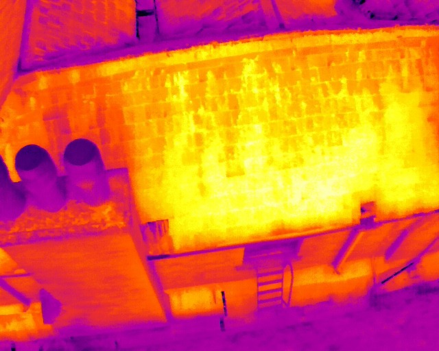
Where it helps, thermal imaging is built into the drone survey to check roofing, building envelope, moisture, solar PV and plant. It is an inspection aid that shows where to look, not a diagnosis on its own.
Get in touch
Your project. Documented from day one.
Drone photography, aerial video, thermal imaging, time-lapse and progress monitoring. Tell Mark the site, the programme and what you need to show.
Safe · Efficient · Detailed · Cost-effective